


Block modelling concepts
The block model is a form of spatially-referenced database that provides a means for modelling a 3D body from point and interval data, such as drillhole sample data. The block model consists of interpolated values instead of true measurements. It provides a method for estimating volume, tonnage, and average grade of a 3D body from sparse drillhole data.
Model space
3D coordinates spatially define the model extents.
Minimum Northing (Y), Easting (X) and Elevation (Z).
Maximum Northing (Y), Easting (X) and Elevation (Z).
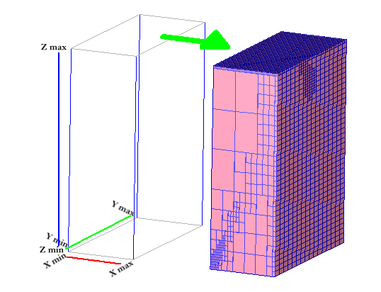
Blocks and attributes
The centroid of each block defines its geometric dimensions in each axis, that is, its Y, X, and Z coordinates. Each block contains attributes for each of the properties to be modelled. The properties or attributes can contain numeric or character string values. Blocks can be of varying size, and you can define the size after the block model is created.
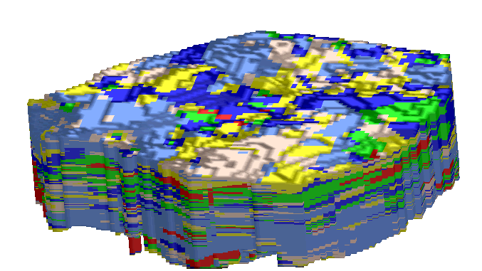
Block model of oil sands coloured by attribute values (bitumen).
Constraints
All block model functions can be performed with constraints. A constraint is a logical combination of one or more spatial objects on selected blocks. Objects that can be used in constraints are plane surfaces, DTMs, solids, closed strings, and block attribute values. Constraints can be saved to a file for rapid re-use. You can use a constraint as a component of another constraint.
Blocks meet a constraint (for example, below a DTM as in the following figures) if its centroid meets that constraint. This is true even if part of the block is above the DTM.
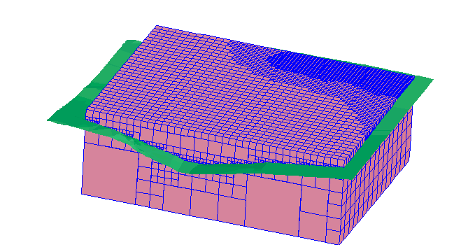
An unconstrained block model in relation to a DTM surface.
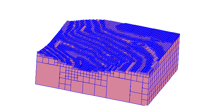
The same block model but constrained by the topography (DTM).
Estimation
After a block model is created and all its attributes are defined, the model must be filled by some estimation method. You can do this by estimating and assigning attribute values from sample data that has X, Y, and Z coordinates, and the attribute values of interest.
The estimation methods that you can use are:
| Method | Description |
|---|---|
|
Nearest Neighbour |
Assigns the value of the closest sample point to a block. |
|
Inverse Distance |
Assigns block values using an inverse distance estimator.
|
|
Assign Value |
Assigns an explicit value to blocks in the model.
|
|
Ordinary Kriging |
Assigns block values using kriging with variogram parameters developed from a geostatistical study.
|
|
Indicator Kriging |
Functions concerned with a probabilistic block grade distribution derived from the kriging of indicators.
|
|
Assign from String |
Assigns data from the description fields of closed segments to attribute values of blocks that are contained within those segments extended in the direction of one of the principal axes (X, Y, or Z).
|
|
Import Centroids |
Assigns block values from data in a delimited or fixed format text file.
|