


Net volume between DTMs
You can use this function to calculate the volume between a DTM and a plane, or between two DTM surfaces. The extents of the volume calculation are determined by the boundary string. You can also use this function to calculate and estimate tonnage, the mean specific gravity, and the mean of any other qualitative parameter in your DTM.
To run this function: Choose Surfaces > Volumes > Net volume between DTMs, or...
Fields on the Surface to surface DTM volumes form
| Field | Description |
|---|---|
| Number of DTMs for volume | The number of DTMs used in the volume calculation. |
| Define first DTM with object and trisolation | |
| Location |
The name and location of the first DTM.
|
 [Refresh] [Refresh] |
Loads the Object ID and Trisolation ID drop-down lists with the objects and trisolations of the DTM. In Surpac 6.6.1 and earlier versions, when you selected a DTM in the Location field, Surpac would load the DTM, validate it, and then load the Object ID and Trisolation ID drop-down lists. You could not interact with the form until the process was complete, which could be a long time for some large DTMs. Now, Surpac does not load the drop-down lists until you click the Refresh button, and validation does not occur until you click Apply in the form. Any validation errors are reported in the Message window. |
| Object ID | The object number for the first DTM. You can type the Object ID or select it from the drop-down list, if the list is loaded. |
| Trisolation ID | The trisolation number for the first DTM. |
| Define second DTM with object and trisolation | |
| Location | The name and location of the second DTM. |
|
[Refresh] |
Loads the Object ID and Trisolation ID drop-down lists with the objects and trisolations of the DTM. |
| Object ID | The object number for the second DTM. You can type the Object ID or select it from the drop-down list, if the list is loaded. |
| Trisolation ID | The trisolation number for the second DTM. |
| Define the boundary string | |
| Use a boundary string |
It is highly recommended that volume calculations are performed inside a boundary string. There are two cases when you would not want to use a boundary string: you are using only one surface, or you are using two surfaces that have identical surface boundaries but no intersecting triangles (coincident faces are acceptable). Imagine that you are viewing a surface along the normal to the plane used during surface creation (that is, looking directly at the plane), the rules for clipping are:
|
| Location | The name and location of the boundary string file. |
| String number | The string number of the boundary string. |
| Quality parameters for volume calculations | |
| Do not use any quality parameters |
No quality parameters are used in the report. The number of quality parameters identified on the Define quality parameters to use form will be zero. |
| Use 1 quality parameter | One quality parameter is used in the report. The number of quality parameters identified on the Define quality parameters to use form will be one. |
| Use 2 quality parameters | Two quality parameters are used in the report. The number of quality parameters identified on the Define quality parameters to use form will be two. |
| Define reporting parameters | |
| Decimals |
The number of decimal places used for the results of the volume calculation.
|
| Density | The density value used when calculating the Nett tonnage and Nett volume. |
| Detailed report |
|
| Report by elevation |
|
| Range | The elevation intervals to use if Report by elevation is selected. |
 Note: The first DTM is assumed to be the upper surface.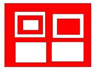
If you selected to use one or two quality parameters, the Define quality parameters to use form is displayed.
Fields on the Define quality parameters to use form
| Field | Description |
|---|---|
| Number of parameters | The number of parameters selected on the Surface to surface DTM volumes form. |
| Sample search method |
The search or weighting method.
|
| Minimum number of points | The minimum number of points used when you select Radial search with inverse distance squared. |
| Define first quality | |
| Name | The name of the first quality parameter. Specific gravity is selected by default. |
| Location | The name and location of the string file that contains the first quality parameter. |
| Field | The field of the string that contains the first quality parameter. |
| Define second quality | |
| Name | The name of the second quality parameter. Specific gravity is selected by default. |
| Location | The name and location of the string file that contains the second quality parameter. |
| Field | The field of the string that contains the second quality parameter. |
After you apply the Define quality parameters to use form, the Define result files for DTM volumes form is displayed.
Fields on the Define result files for DTM volumes form
| Field | Description |
|---|---|
| Location | The name and location to save the report file. |
| Report file format | The file format to use for the report. Options are; .not, .csv, .htm, .html, .rtf, .pdf, and .ps. |
| Save results to new boundary string file |
|
| Location | The name and location to save the new boundary string file. |
After you apply the Define result files for DTM volumes form, the Save a modified DTM form is displayed.
Fields on the Save a modified DTM form
| Field | Description |
|---|---|
| Save the modified DTM |
|
| Location | The name and location to save the new DTM. |
Output
A string file with the same name, location, and ID number as the report is created. This file contains all segments of the boundary string with the volume results in different D fields of each of the boundary segments.
You can use these boundary strings with the results for plotting the results on maps, or for use in the Surpac scheduling tools to define ore quantities and grades.
The results that are saved to the D fields are described below:
| Field | Results |
|---|---|
| D1 | Slope area of the first DTM. |
| D2 | Slope area of the second DTM. |
| D3 | Area of the boundary segment. |
| D4 | Volume between the two DTMs, or between the DTM and the horizontal data plane. |
| D5 | Average thickness. That is the volume divided by the area of the boundary segment. |
| D6 |
The total for the first quality parameter. |
| D7 | The average value of the first quality parameter. |
| D8 | The total for the second quality parameter. |
| D9 | The average value of the second quality parameter. |
You can also report this information by elevation by selecting Report by Elevation. If you report by elevation,the description fields contain the grand total values, and not the totals of the elevation range reported.
Troubleshooting
 DTMs created prior and post Surpac 6.2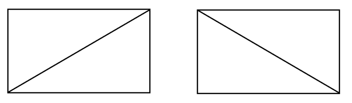
| Message | Description |
|---|---|
Geometry problem
					found near y=YYY x=XXX, cannot recover
|
A geometry problem has been encountered at the specified point. The recommended course of action is:
|
The selected DTMs were not created on the same plane.
|
The DTMs used must be created on the same plane. Choose different DTMs, recreate the DTMs on the same plane, or transform the data in one of the DTMs to match the plane of the other. |