Create longitudinal profile
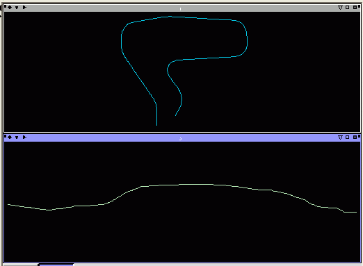
The create longitudinal function is used to transform a horizontal road design that has been draped over a surface, into a form that is very easy to work with in the vertical design domain. It allows you to visualise and edit the vertical design of a road with the elevation of the road plotted against its chainage. Typically, you will apply this function to a segment that has first been created using design horizontal alignment, and then draped over a dtm.
To run this function: Choose Create > Longitudinal profile, or Design > Road design > Create longitudinal profile, or...
After starting this function, it will prompt for the road centreline that you wish to create a longitudinal profile from. After you select your road centreline, the Create longitudinal profile form appears:
Input
| Source layer | The layer that the horizontal centreline is in. |
| Source string | The string that the horizontal centreline is in. |
| Source segment | The segment in the string that is the horizontal centreline. |
| Use DField (D2) for chainage | If this is checked, the values in D2 will be used as the chainage for each point. If any point is missing D2, then its chainage will be interpolated based on the 2D line distance in the XY plane. |
Output
| Output layer | The layer that the longitudinal profile will be created in |
| Join the start of the outline | The string that will contains the longitudinal profile |
| Join the end of the outline | The view scale factor in the Z direction of the new view looking at our profile. It often useful to exaggerate the data in the elvation to make it easier to see slope changes. |
After clicking Apply, you will see a result something like this.